Runde von Oker I
Kästeklippen - Mousetrap
Hiking trailsAs the name suggests, the "Kästeklippen - Mausefalle Runde von Oker" starts in Oker and leads several kilometres further south to hiking highlights such as the Kästeklippen, the Mausefalle and the Hexenküche. The route turns at the southernmost point at the Oker Dam and then heads north again past highlights such as the Engagement Island, the equalising basin of the Oker Dam, the Marienwand and the Eagle ' s Cliff. eagle cliff. The hike stretches over a total length of 14 kilometres and requires a good level of fitness and suitable equipment and takes around four and a half hours.
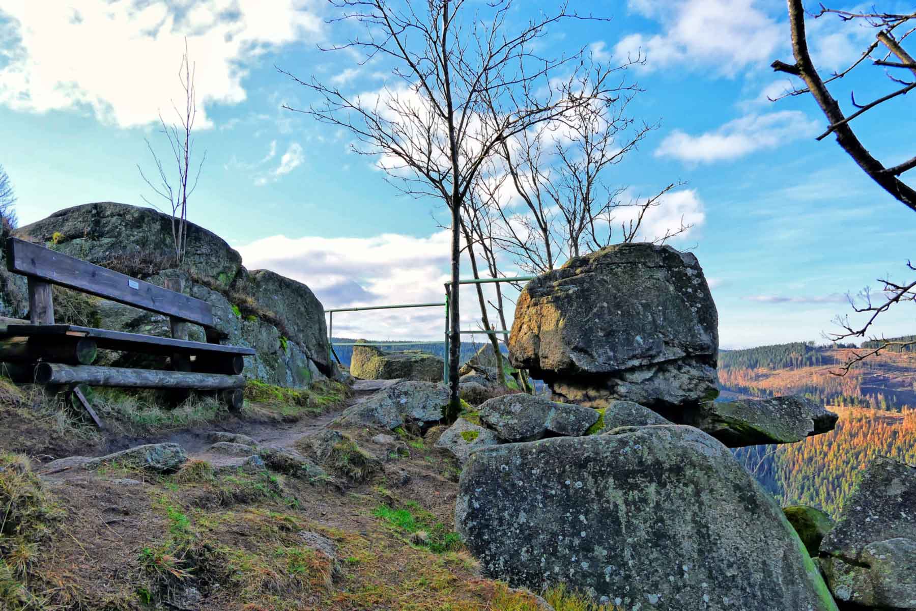
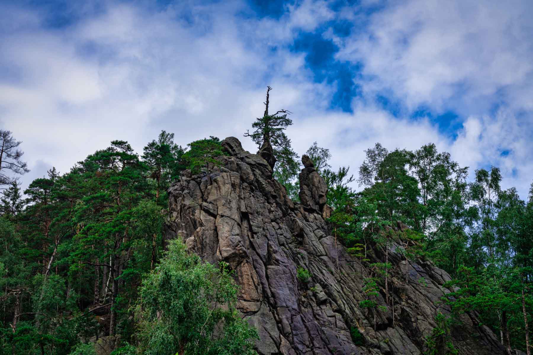
As described, it starts at the bus platform of the Oker church bridge about 5 kilometres to the south. A little further behind Kästestraße, the eponymous Kästeklippen finally appear. Shortly before this, you have the opportunity to stamp the Harz Hiking Needle at stamp box 118 or take a break at the associated bench. At their highest point, the spectacular cliffs form the summit of the Huthberg at a height of 604.8 metres, from where the view of the Oker dam is particularly breathtaking at sunset. The Kästeklippe is often referred to as the "Old Man" , as its shape is reminiscent of the face of an old man. With a little imagination, you can draw the eyes, nose and mouth.
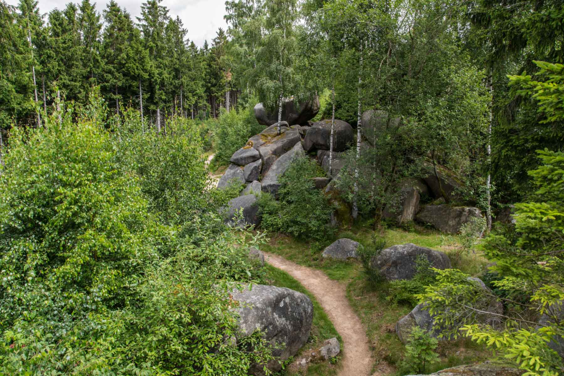
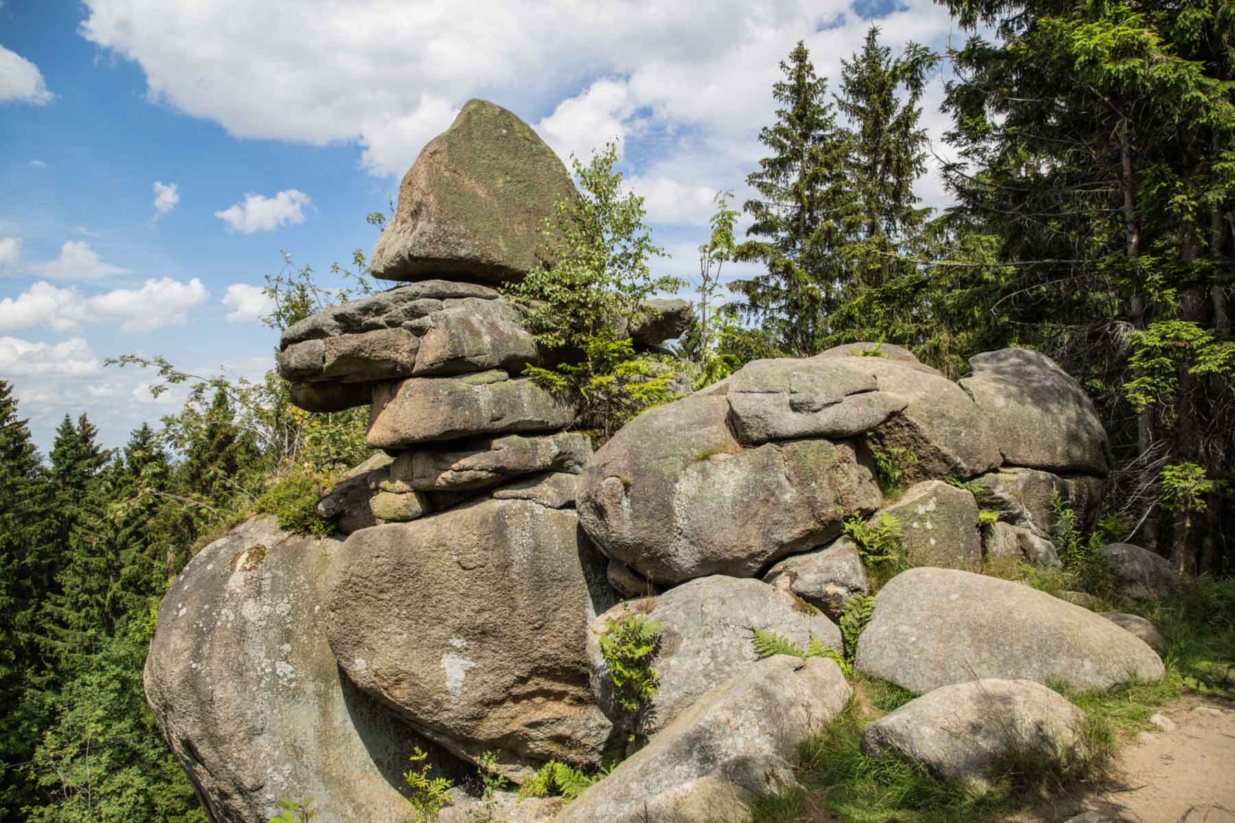
A few hundred metres further on, the so-called "witches' kitchen" appears. The weathered rock formation consists of solid granite rocks that form a constellation worth seeing . A similar highlight is the Mausefalle, which is a little further on and looks similar to the Hexenküche and is named after a large rock that has been supported by a much smaller one for centuries. The upper granite boulder lies particularly close to the edge, as if the mousetrap is about to snap shut.
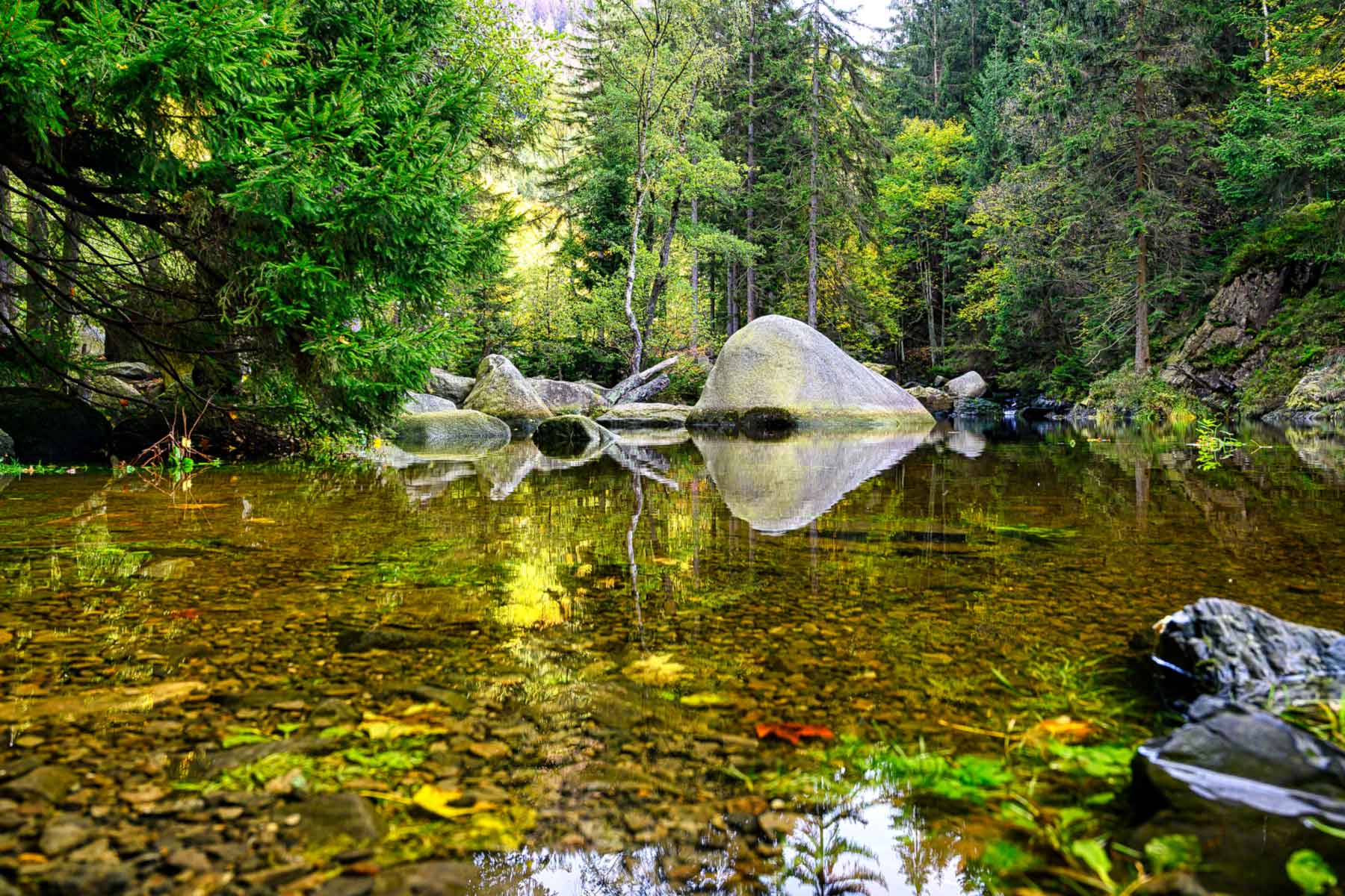
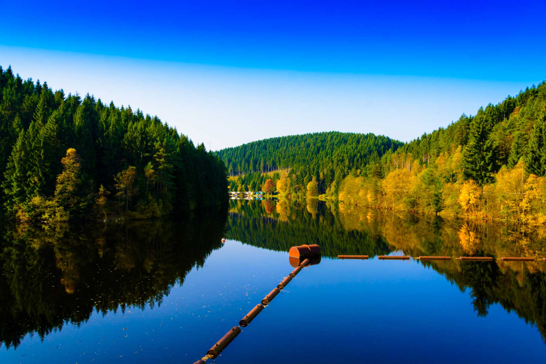
After reaching the southernmost point of the hike at the Oker dam, the route continues a few kilometres further north, where the next highlight waiting to be discovered is Verlobungsinsel. The small island surrounded by the Oker invites you to have a picnic and relax - an ideal resting place with the Harz Hiking Needle stamp box 116.
A little further along the Oker to the north is the equalising reservoir of the Oker dam. The equalising basin is the reservoir of the larger (previously seen) Oker dam and invites you to linger thanks to the trees growing right up to the banks and the fantastic panorama. After a little less than 10 kilometres from the start of the hike, the Marienwand finally appears. The rock face attracts climbers who abseil down it, especially in the summer months. So if you want, you can get active here yourself or relax and watch the pros climb.
The final highlight along the hiking trail is the Adlerklippe cliff further north: similar to the previous Marienwand, you can often find some climbers here. (Occasionally there is also a temporary stamp of the Harz hiking pin here). If you continue northwards from the Adlerklippe along the Oker, you will return to the starting point where the hike ends.
Talstr. 5
38642 Goslar
Harzspots gives you the
Komoot Harz Region Package for free!
Use our voucher from the Outdoor Navigators Komoot and get the „Harz Regions Package“ free of charge. From now on you can get to know all hiking and cycling routes digitally and, if you wish, also voice-guided!