Brockengipfel

Via the Torfhausblick and the Brocken railway to the summit
Hiking trailsOur "Brockengipfel - Torfhausblick Runde" leads along easy paths from the cemetery of honour via sights such as the boundary stone, the "Dreieckiger Pfahl" refuge and the Torfhausblick past the Brocken railway to the summit of the Brocken. The hiking route then leads back the same way and takes just over four hours in total, depending on how much time you spend at the individual attractions.
The starting point is the bus stop at the cemetery of honour, whereupon the route takes hiking enthusiasts straight along Schierker Straße to the first hiking highlight, the "Grenzstein - Dreieckiger Pfahl". This is a historical boundary marker that still marks the borders of the two federal states of Lower Saxony and Saxony-Anhalt. Just a few metres further on, the Dreieckiger Pfahl refuge of the same name awaits at the crossroads and invites you to take a break. The stamp box 168 of the Harz Hiking Needle is also located here.
If you continue northwards from the crossroads along the Goethe Trail, you will reach the Hexen-Stieg station "Stichwortfahnen". The flags set up here are labelled with information and key words and are reminiscent of the inner-German border. If you want, you can take a short break on the seats in between.
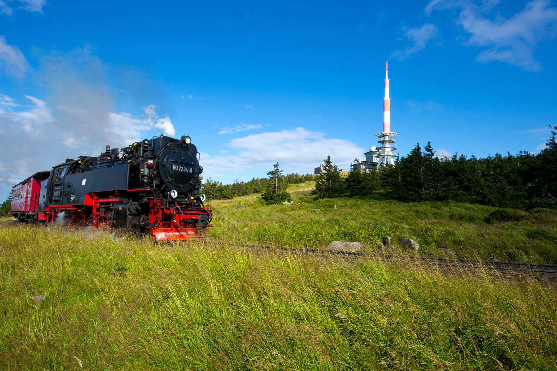
A few hundred metres further along the Goetheweg in a northerly direction, you will be rewarded with a wonderful south-westerly view at the Torfhausblick. The tracks of the Brocken railway, which is the next highlight of the hike, are only a short distance behind the viewpoint over the Torfhaus. Every Harz enthusiast must have travelled on it at least once, as the ride on the old steam locomotive is not only an experience for nostalgics, but above all for the whole family. Thanks to the rails running alongside the route, the steam locomotive can be observed at close quarters as it puffs its way up the Brocken.
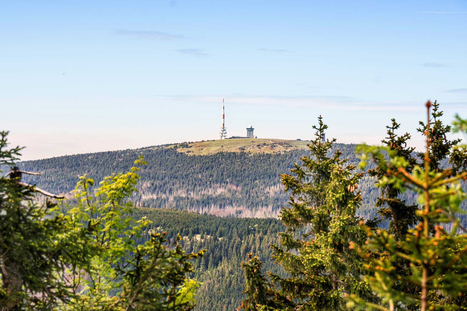
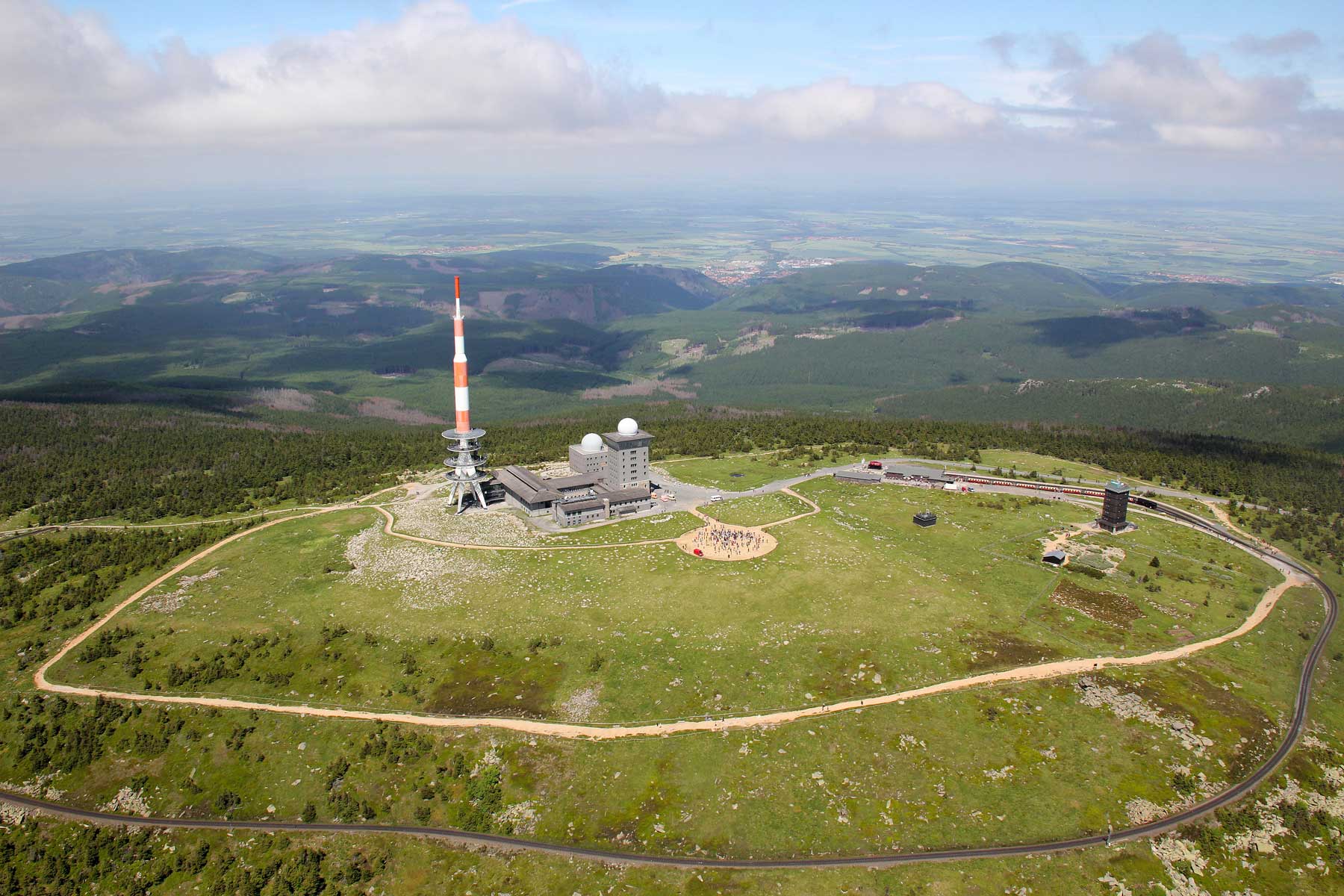
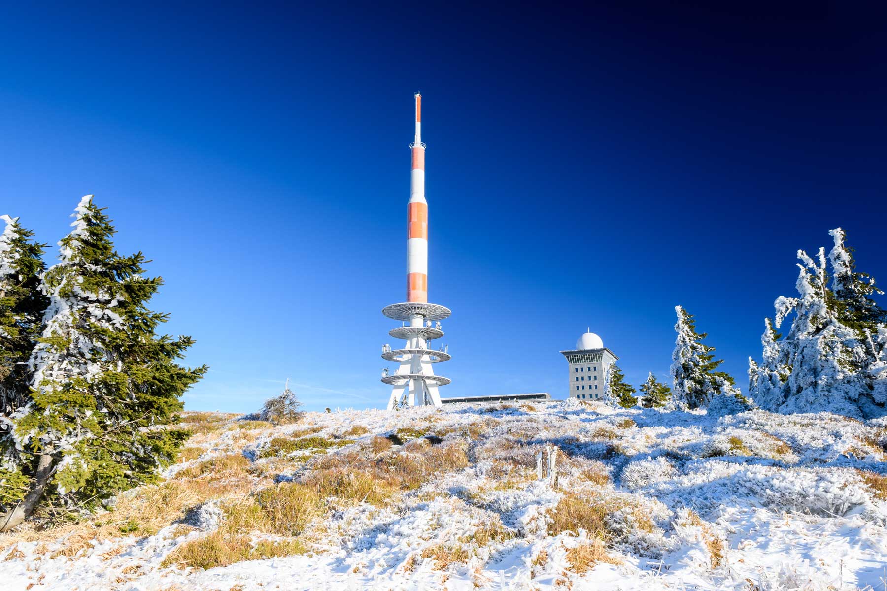
After almost 5 kilometres of hiking, you reach the 1000m altitude limit for the first time. A sign here symbolises that you have passed the 1000 metre mark, from where it is only about 150 metres to the Brocken summit . Once there, a wonderful view awaits (apart from the fog). With a bit of luck, the fog won't be too thick and the view from the highest point in Saxony-Anhalt will shine in all its glory. The radio tower and radar domes are also characteristic of the summit of the Brocken, which is 1,141 metres above sea level. Warm clothing is definitely recommended here, as even in summer you can expect brief cold spells and fog.
The way back is less spectacular and follows the same route. At least you can marvel at all the sights again in reverse order.
Schierker Str.
38667 Sankt Andreasberg
Harzspots gives you the
Komoot Harz Region Package for free!
Use our voucher from the Outdoor Navigators Komoot and get the „Harz Regions Package“ free of charge. From now on you can get to know all hiking and cycling routes digitally and, if you wish, also voice-guided!