

Runde von Bad Harzburg
View of the Brocken - Großer Burgberg (HWN 121)
Hiking trailsThis hiking circuit is located outside (south-east) of Bad Harzburg and starts at the large car park in Bad Harzburg on Nordhäuser Straße. The hiking trail then leads along the Philosophenweg past the Schweineteich pond and then zigzags up to the large castle hill and the Harzburg ruins on top.
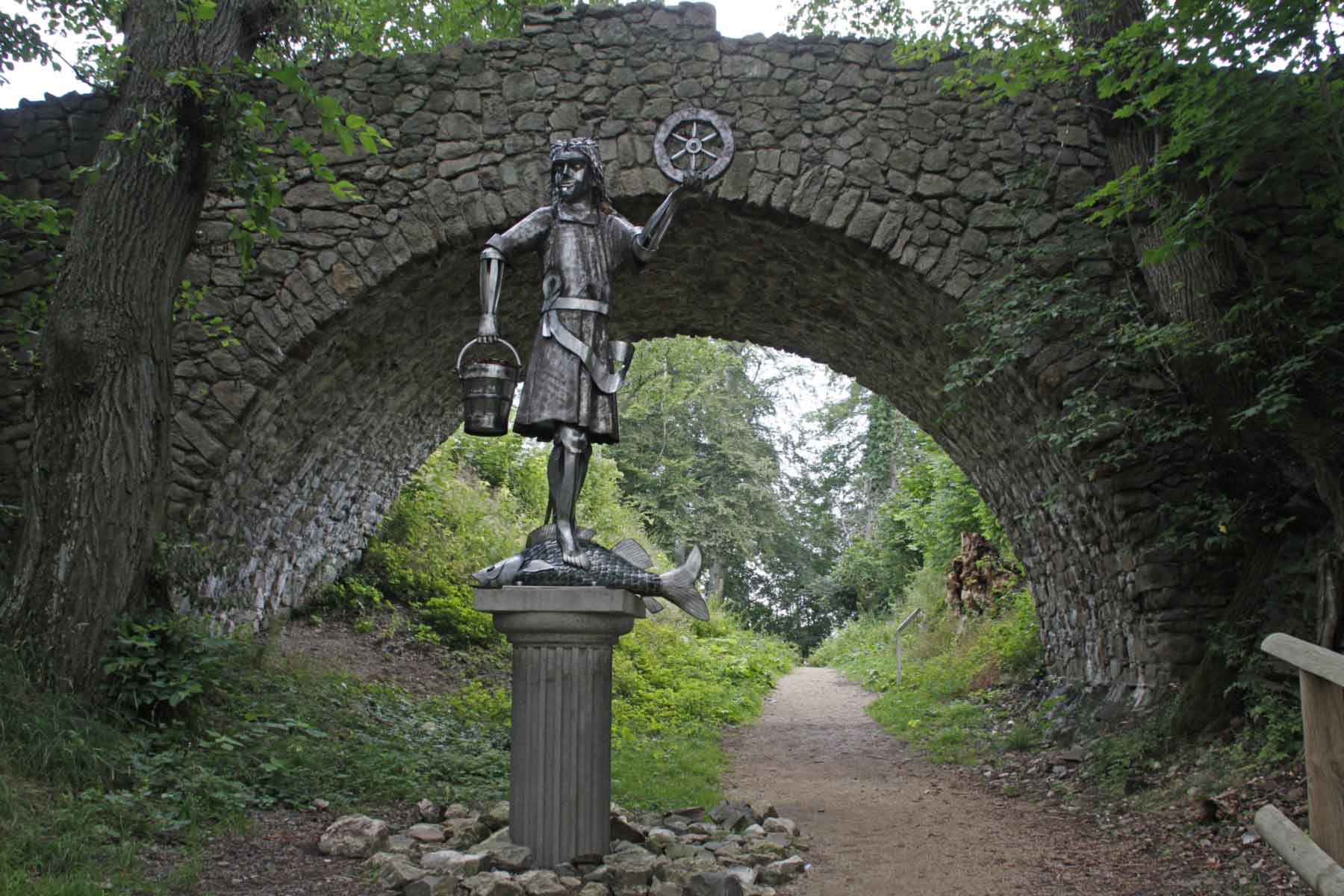
It was once used to secure the imperial palace of Goslar and was therefore strategically located on the castle hill. Unfortunately, very little remains of the Harzburg, with only a few walls, the fountain and a restored tower reminding us of the Harzburg ruins today. Due to its high location, you can enjoy the distant view of Bad Harzburg from here. Especially in combination with the "Aussichtsreich" restaurant, the cable car, the Krodo statue, the Canossa monument and the stamp point, it is definitely worth a visit.
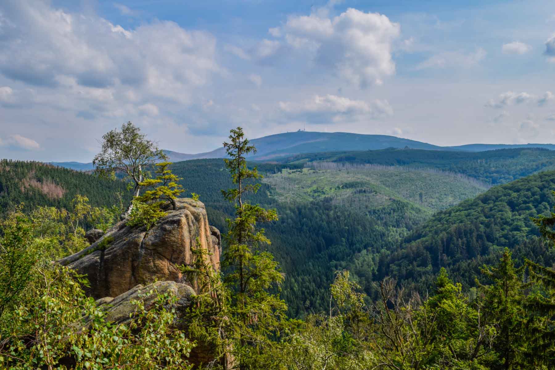
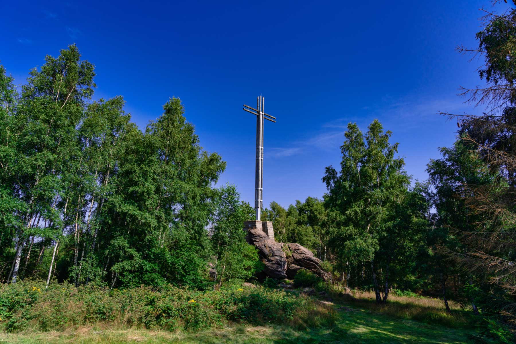
After a rest on the Burgberg, the route continues along the Kaiserweg to the "View of the Brocken", from where the Brocken can be recognised in good visibility. A few kilometres further on, at the northernmost point of the hiking circuit, is the Cross of the German East, a memorial cross commemorating the former German eastern territories. The former 20.5 metre high wooden cross fell over in 1998 and was subsequently replaced by the 17.7 metre high steel cross that is visible today.
A few kilometres further south, you finally reach the panoramic trail above the Stötertal valley. The next highlight is a little further on at the Rabenklippen: the lynx enclosure. In the wild, lynxes are typically very shy animals, which is why you can watch them here as they climb trees, sneak around their territory or simply laze around. The route then curves back to Bad Harzburg via the Kaiserweg.
Nordhäuser Str. 12A
38667 Bad Harzburg
Harzspots gives you the
Komoot Harz Region Package for free!
Use our voucher from the Outdoor Navigators Komoot and get the „Harz Regions Package“ free of charge. From now on you can get to know all hiking and cycling routes digitally and, if you wish, also voice-guided!